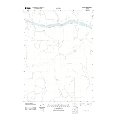
2011 Map of Bassett NW
USGS Topo · Published 2011About this map
The Niobrara River carves through this northern Nebraska landscape, serving as a primary geographic anchor for a region defined by its deep creek valleys and remote rural infrastructure. The river is spanned by the McLain Bridge, providing a critical crossing point between the dissected tablelands. To the north and south of the river valley, the terrain is marked by a network of drainage systems including Dry Creek, Thomas Creek, and the winding Long Pine Creek, which flows near the Camp Meeting Ground.
Find a feature on this map
17 named features on this map. Tap any name to fly to it.
Don’t see what you’re looking for? This feature index may not catch every label — zoom into the map to look around manually.
Map Details
Editions of this 2011 Bassett NW Map
This is the sole edition of this map. No revisions or reprints were ever made.
Other maps of this area

1949 · Dutch Creek
USGS Topo · 1:24,000

1949 · Riverview
USGS Topo · 1:24,000

1950 · Bassett NW
USGS Topo · 1:24,000

1950 · Riverview
USGS Topo · 1:24,000

1950 · Meadville
USGS Topo · 1:24,000

1950 · Dutch Creek
USGS Topo · 1:24,000

1954 · Ainsworth
USGS Topo · 1:24,000

1954 · Long Pine
USGS Topo · 1:24,000

1954 · Bassett
USGS Topo · 1:24,000

1955 · O'Neill
USGS Topo · 1:250,000