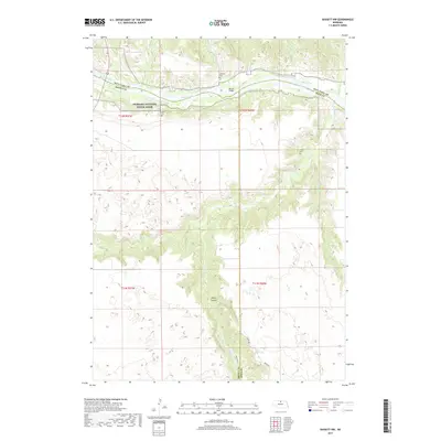
2017 Map of Bassett NW
USGS Topo · Published 2017About this map
The Niobrara National Scenic River corridor dominates the northern reaches of this landscape where Keya Paha, Brown, and Rock counties converge. The winding river valley is fed by numerous drainages, including Long Pine Creek and Bone Creek, creating a deeply dissected terrain that contrasts sharply with the tablelands to the south. Local family history is preserved at small burial sites such as Leonard Cemetery and Hulshizer Cemetery near the riverbanks, while the Putnam Cemetery sits further south overlooking the creek breaks. The northern portion is accessible via McLain Bridge, providing a crossing over the Niobrara. Further south, the dramatic topography of Devils Canyon highlights the erosive force of the local water network in this part of the Nebraska Sandhills region.
Find a feature on this map
27 named features on this map. Tap any name to fly to it.
Don’t see what you’re looking for? This feature index may not catch every label — zoom into the map to look around manually.
Map Details
Editions of this 2017 Bassett NW Map
This is the sole edition of this map. No revisions or reprints were ever made.
Other maps of this area

1949 · Dutch Creek
USGS Topo · 1:24,000

1949 · Riverview
USGS Topo · 1:24,000

1950 · Bassett NW
USGS Topo · 1:24,000

1950 · Riverview
USGS Topo · 1:24,000

1950 · Meadville
USGS Topo · 1:24,000

1950 · Dutch Creek
USGS Topo · 1:24,000

1954 · Ainsworth
USGS Topo · 1:24,000

1954 · Long Pine
USGS Topo · 1:24,000

1954 · Bassett
USGS Topo · 1:24,000

1955 · O'Neill
USGS Topo · 1:250,000