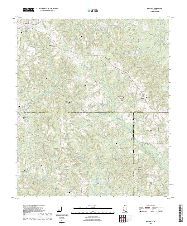
2024 Map of Bassfield
USGS Topo · Published 2024About this map
Family legacies and rural settlements define this landscape in the Pine Belt region, where the borders of Jefferson Davis, Marion, and Lamar counties converge. The town of Bassfield serves as the primary hub in the northwest, surrounded by a dense network of ancestral burial grounds including the Bassfield City Cem and Wheeler Cem. The map reveals a land divided by the headwaters of Black Creek and Gum Swamp Creek, where the terrain is marked by decades of local history preserved in names like the Stewart - Thompson Cem and Magee - Sullivan Cem. Small crossroads communities such as Morris, Melba, and Hickory Grove are connected by a web of local roads including Old Hwy 42E, reflecting the persistent settlement patterns of south-central Mississippi. Researchers can trace numerous family-named landmarks like the Jacob McPhail Cem and Williamson Cem that dot the wooded countryside.
Find a feature on this map
114 named features on this map. Tap any name to fly to it.
Don’t see what you’re looking for? This feature index may not catch every label — zoom into the map to look around manually.
Map Details
Editions of this 2024 Bassfield Map
This is the sole edition of this map. No revisions or reprints were ever made.
Other maps of this area

1953 · Hattiesburg
USGS Topo · 1:250,000

1958 · Hattiesburg
USGS Topo · 1:250,000

1970 · Bunker Hill
USGS Topo · 1:24,000

1970 · Columbia North
USGS Topo · 1:24,000

1970 · Prentiss East
USGS Topo · 1:24,000

1974 · Sumrall
USGS Topo · 1:24,000

1974 · Oloh
USGS Topo · 1:24,000

1974 · Williamsburg
USGS Topo · 1:24,000

1974 · Bassfield
USGS Topo · 1:24,000

1974 · Lake Mike Connor
USGS Topo · 1:24,000