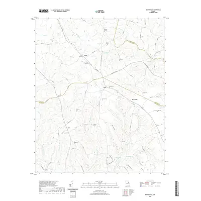
2020 Map of Bastonville
USGS Topo · Published 2020About this map
Reese and Bastonville sit along the rolling landscape of eastern Georgia, defined by a dense network of family-named cemeteries and rural roads. This survey reveals a deeply established residential and agricultural pattern, where family legacies are literally written onto the terrain through sites like Abbott Cem, Norris Cem, and the Reese-Norris Cem. The southern portion of the area features more concentrated water bodies, including Blankenship Pond and the headwaters of Blue Spring Br.
Find a feature on this map
89 named features on this map. Tap any name to fly to it.
Don’t see what you’re looking for? This feature index may not catch every label — zoom into the map to look around manually.
Map Details
Editions of this 2020 Bastonville Map
This is the sole edition of this map. No revisions or reprints were ever made.
Other maps of this area

1920 · Stapleton
USGS Topo · 1:62,500

1922 · Harlem
USGS Topo · 1:62,500

1948 · Harlem
USGS Topo · 1:62,500

1948 · Stapleton
USGS Topo · 1:62,500

1948 · Thomson East
USGS Topo · 1:24,000

1950 · Dearing
USGS Topo · 1:24,000

1950 · Wrens
USGS Topo · 1:24,000
1950 · Bowdens Pond
USGS Topo · 1:24,000

1953 · Athens
USGS Topo · 1:250,000

1958 · Athens
USGS Topo · 1:250,000