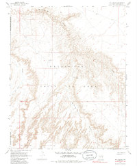
1967 Map of Bat Canyon
USGS Topo · Published 1986About this map
The Moenkopi Plateau dominates the southern landscape of this 1960s survey, representing a high-desert environment defined by dramatic topographical relief and isolated water sources. Centered within the Navajo-Hopi Joint Use Area, the map documents a territory where life was organized around rare water points such as Nez Spring and the Water Tank. The drainage patterns of Coal Mine Canyon and Ha Ho No Geh Canyon cut through the plateau, showcasing the complex erosional geography of Coconino County. Human utility in this arid region is marked by the presence of the Sleepy Hill Windmill, a vital landmark for land management during this period. The map's detail provides an important look at the boundary lines of the Navajo Indian Reservation as they stood before later administrative shifts, preserving the mid-century spatial arrangement of this ancestral land.
Find a feature on this map
9 named features on this map. Tap any name to fly to it.
Don’t see what you’re looking for? This feature index may not catch every label — zoom into the map to look around manually.
Map Details
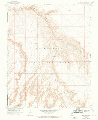
Editions of this 1967 Bat Canyon Map
2 editions found
Other maps of this area

1883 · Marsh Pass
USGS Topo · 1:250,000

1883 · Tusayan
USGS Topo · 1:250,000

1886 · Tusayan
USGS Topo · 1:250,000

1886 · San Francisco Mtns
USGS Topo · 1:250,000

1886 · Echo Cliffs
USGS Topo · 1:250,000

1891 · San Francisco Mtns
USGS Topo · 1:250,000

1891 · Echo Cliffs
USGS Topo · 1:250,000

1892 · Marsh Pass
USGS Topo · 1:250,000

1894 · San Francisco Mtns
USGS Topo · 1:250,000

1899 · San Francisco Mtns
USGS Topo · 1:250,000