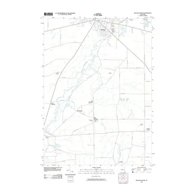
2010 Map of Batavia South
USGS Topo · Published 2010About this map
Tonawanda Creek snakes through this rural landscape south of the city of Batavia, where agricultural land and small crossroads settlements have long defined the character of Genesee County. The map provides extensive detail for genealogists, recording numerous burial grounds including Saint Joseph Cemetery, Elmwood Cemetery, and the West Bethany Rural Cemetery.
Find a feature on this map
65 named features on this map. Tap any name to fly to it.
Don’t see what you’re looking for? This feature index may not catch every label — zoom into the map to look around manually.
Map Details
Editions of this 2010 Batavia South Map
This is the sole edition of this map. No revisions or reprints were ever made.
Other maps of this area

1897 · Albion
USGS Topo · 1:62,500

1897 · Medina
USGS Topo · 1:62,500

1904 · Batavia
USGS Topo · 1:62,500

1905 · Attica
USGS Topo · 1:62,500

1944 · Alexander
USGS Topo · 1:31,680

1944 · Byron
USGS Topo · 1:31,680

1944 · Stafford
USGS Topo · 1:31,680

1949 · Attica
USGS Topo · 1:62,500

1949 · Alexander
USGS Topo · 1:24,000
1949 · Attica
USGS Topo · 1:24,000