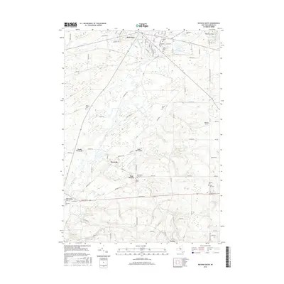
2016 Map of Batavia South
USGS Topo · Published 2016About this map
Tonawanda Creek and its tributary, Little Tonawanda Cr, define the rural geography south of the Genesee County seat. This landscape is characterized by a dense network of country roads connecting small settlements like Brookville, East Alexander, and West Bethany. The area serves as a significant record of local genealogy, containing numerous burial grounds such as the Saint Joseph Cem and Batavia Cem in the north, and the West Bethany Rural Cem and Maple Lawn Cem further south. The presence of the Bethany Airpark and named water features like Seven Springs Pond highlight the mixed use of this territory, from agriculture to small-scale aviation and natural springs. The intricate web of named streets and township lines provides a clear view of land division and property access in the modern era.
Find a feature on this map
93 named features on this map. Tap any name to fly to it.
Don’t see what you’re looking for? This feature index may not catch every label — zoom into the map to look around manually.
Map Details
Editions of this 2016 Batavia South Map
This is the sole edition of this map. No revisions or reprints were ever made.
Other maps of this area

1897 · Albion
USGS Topo · 1:62,500

1897 · Medina
USGS Topo · 1:62,500

1904 · Batavia
USGS Topo · 1:62,500

1905 · Attica
USGS Topo · 1:62,500

1944 · Alexander
USGS Topo · 1:31,680

1944 · Byron
USGS Topo · 1:31,680

1944 · Stafford
USGS Topo · 1:31,680

1949 · Attica
USGS Topo · 1:62,500

1949 · Alexander
USGS Topo · 1:24,000
1949 · Attica
USGS Topo · 1:24,000