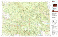
1987 Map of Bates
USGS Topo · Published 1987About this map
The Sumpter Valley Railroad corridor anchors this 1987 survey of the high mountain country where Grant and Baker counties meet. Mining history is deeply etched into the landscape of the Blue Mountains, with a high concentration of named workings such as the Standard Mine, Dixie Meadows Mine, and the Cracker Oregon Mine clustered near Elkhorn Ridge. This map captures the region at a time when the legacy of early gold mining towns like Sumpter, Bourne, and Greenhorn remained visible alongside the modern timber and water management infrastructure of the Whitman National Forest.
Find a feature on this map
58 named features on this map. Tap any name to fly to it.
Don’t see what you’re looking for? This feature index may not catch every label — zoom into the map to look around manually.
Map Details
Editions of this 1987 Bates Map
This is the sole edition of this map. No revisions or reprints were ever made.
Other maps of this area

1901 · Baker City
USGS Topo · 1:125,000

1901 · Sumpter
USGS Topo · 1:125,000

1906 · Telocaset
USGS Topo · 1:125,000

1908 · Ironside Mountain
USGS Topo · 1:125,000

1940 · Mount Vernon
USGS Topo · 1:62,500

1940 · John Day
USGS Topo · 1:62,500

1943 · John Day
USGS Topo · 1:62,500

1943 · Mount Vernon
USGS Topo · 1:62,500

1949 · Long Creek
USGS Topo · 1:62,500

1949 · Susanville
USGS Topo · 1:62,500