
1940 Map of John Day
USGS Topo · Published 1960About this map
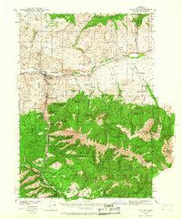
Canyon City and John Day serve as the primary hubs in this late 1930s survey of Grant County, Oregon. The landscape is defined by the transition from the John Day River valley floor to the high peaks of the Strawberry Mountains and Malheur National Forest. The map documents a significant mining history, particularly south of the river, with numerous sites labeled as abandoned including the Golden West Mines, Great Northwestern Mine, and Ward Mine. Along the John Day Highway, smaller rural landmarks like the Trowbridge Ranch and Oliver Ranch indicate the agricultural character of the valley. Of particular note for local historians is the Joaquin Miller Resort at the southern edge and the Grant Union High Sch centrally located between the two main settlements, alongside an early Emergency Landing Field just west of John Day.
Find a feature on this map
71 named features on this map. Tap any name to fly to it.
Don’t see what you’re looking for? This feature index may not catch every label — zoom into the map to look around manually.
Map Details
Editions of this 1940 John Day Map
2 editions found
Other maps of this area

1940 · Mount Vernon
USGS Topo · 1:62,500

1943 · John Day
USGS Topo · 1:62,500

1943 · Mount Vernon
USGS Topo · 1:62,500

1949 · Long Creek
USGS Topo · 1:62,500

1949 · Susanville
USGS Topo · 1:62,500

1951 · Susanville
USGS Topo · 1:62,500

1951 · Long Creek
USGS Topo · 1:62,500

1951 · Bates
USGS Topo · 1:62,500

1955 · Canyon City
USGS Topo · 1:250,000

1959 · Canyon City
USGS Topo · 1:250,000