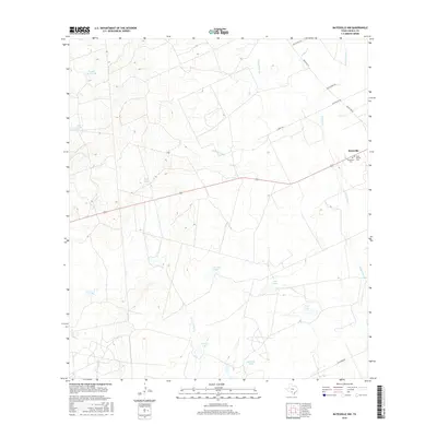
2016 Map of Batesville NW
USGS Topo · Published 2016About this map
Batesville serves as the primary community on this survey of northwestern Zavala County, situated along the eastern edge of the map. The landscape is defined by an intricate network of ephemeral water features and man-made reservoirs common to this arid ranching region, including Kiefer Lake, Indio Tank, and Cutoff Rock Tank. The drainage pattern is dictated by several key watercourses such as Gallina Cr and Tortuga Cr, which are supplemented by sloughs like Childers Slough and Gallina Slough. Significant local landmarks for genealogists and researchers include Woodlawn Cem and Saint Patrick Cem, both located near the settlement. Transportation in the mid-2010s is anchored by Route 57 and several rural thoroughfares including High Fence Rd and Ranch Rd 117, providing access to the more remote areas like Cow Hill.
Find a feature on this map
24 named features on this map. Tap any name to fly to it.
Don’t see what you’re looking for? This feature index may not catch every label — zoom into the map to look around manually.
Map Details
Editions of this 2016 Batesville NW Map
This is the sole edition of this map. No revisions or reprints were ever made.
Other maps of this area

1898 · Uvalde
USGS Topo · 1:125,000

1899 · Uvalde
USGS Topo · 1:125,000

1939 · La Pryor
USGS Topo · 1:62,500

1953 · Crystal City
USGS Topo · 1:250,000

1954 · San Antonio
USGS Topo · 1:250,000

1955 · Crystal City
USGS Topo · 1:250,000

1957 · San Antonio
USGS Topo · 1:250,000

1957 · Batesville
USGS Topo · 1:62,500

1960 · Pulliam Ranch
USGS Topo · 1:24,000

1961 · Crystal City
USGS Topo · 1:250,000