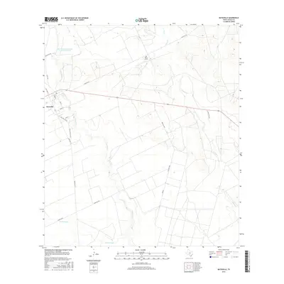
2016 Map of Batesville
USGS Topo · Published 2016About this map
Batesville serves as the primary hub in this South Texas landscape, situated at the intersection of several regional thoroughfares including Ranch Rd 187 and Ranch Rd 117. The surrounding terrain is defined by the winding course of the Leona River, which snakes south through a patchwork of ranch lands and agricultural plots. This drainage system is bolstered by the Gallina Slough to the south and Liveoak Cr to the north, reflecting a riparian network essential for livestock and irrigation in this semi-arid environment.
Find a feature on this map
22 named features on this map. Tap any name to fly to it.
Don’t see what you’re looking for? This feature index may not catch every label — zoom into the map to look around manually.
Map Details
Editions of this 2016 Batesville Map
This is the sole edition of this map. No revisions or reprints were ever made.
Other maps of this area

1898 · Uvalde
USGS Topo · 1:125,000

1899 · Uvalde
USGS Topo · 1:125,000

1928 · Frio Town
USGS Topo · 1:62,500

1942 · Divot
USGS Topo · 1:62,500

1953 · Crystal City
USGS Topo · 1:250,000

1954 · San Antonio
USGS Topo · 1:250,000

1955 · Crystal City
USGS Topo · 1:250,000

1956 · Divot
USGS Topo · 1:62,500

1957 · San Antonio
USGS Topo · 1:250,000

1957 · Batesville
USGS Topo · 1:62,500