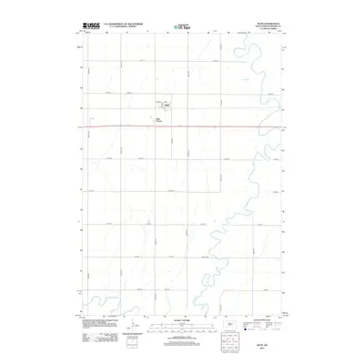
2012 Map of Bath
USGS Topo · Published 2012About this map
The James River snakes heavily through the eastern portion of this Brown County landscape, its tight meanders defining the local topography just before the river dips south. The small community of Bath serves as the primary hub, anchored by its Po and neighboring Bath Corner. The surrounding terrain is organized by a strict section-line grid of roads, including 131st St and 393rd Ave, which partition the agricultural fields of Bath Township. To the south, the German Cem sits in an isolated position near the riverbanks, offering a primary point of interest for genealogists tracing early families of the area. The southwest corner is touched by Moccasin Cr, adding a secondary drainage feature to this prairie landscape mapped in the early 21st century.
Find a feature on this map
22 named features on this map. Tap any name to fly to it.
Don’t see what you’re looking for? This feature index may not catch every label — zoom into the map to look around manually.
Map Details
Editions of this 2012 Bath Map
This is the sole edition of this map. No revisions or reprints were ever made.
Other maps of this area

1894 · Columbia
USGS Topo · 1:62,500

1895 · Aberdeen
USGS Topo · 1:125,000

1896 · Columbia
USGS Topo · 1:125,000

1952 · Columbia
USGS Topo · 1:24,000

1952 · Ordway
USGS Topo · 1:24,000

1952 · Putney
USGS Topo · 1:24,000

1953 · Stratford
USGS Topo · 1:24,000

1953 · Groton SW
USGS Topo · 1:24,000

1953 · Warner
USGS Topo · 1:24,000

1954 · Bath
USGS Topo · 1:24,000