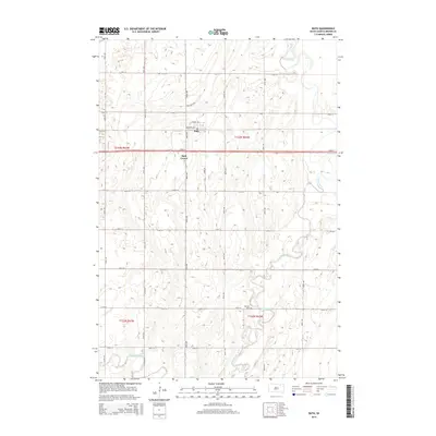
2015 Map of Bath
USGS Topo · Published 2015About this map
The settlement of Bath and the nearby Bath Corner anchor this portion of Brown County, where the agricultural grid meets the winding course of the James River. The landscape is defined by the river’s complex meanders and oxbows, which dominate the eastern half of the quadrangle and create a distinct contrast with the orderly mile-section roads like 133rd St and 395th Ave. Significant local landmarks include the German Cem located near the riverbank and Moccasin Creek in the southwest. The presence of Railroad Ave and Mallard Pass reflects the importance of transportation corridors in this rural prairie setting, where the township boundaries of T123N R62W and T122N R62W converge. This survey provides a precise look at the drainage patterns and land divisions of the James River Valley.
Find a feature on this map
27 named features on this map. Tap any name to fly to it.
Don’t see what you’re looking for? This feature index may not catch every label — zoom into the map to look around manually.
Map Details
Editions of this 2015 Bath Map
This is the sole edition of this map. No revisions or reprints were ever made.
Other maps of this area

1894 · Columbia
USGS Topo · 1:62,500

1895 · Aberdeen
USGS Topo · 1:125,000

1896 · Columbia
USGS Topo · 1:125,000

1952 · Columbia
USGS Topo · 1:24,000

1952 · Ordway
USGS Topo · 1:24,000

1952 · Putney
USGS Topo · 1:24,000

1953 · Stratford
USGS Topo · 1:24,000

1953 · Groton SW
USGS Topo · 1:24,000

1953 · Warner
USGS Topo · 1:24,000

1954 · Bath
USGS Topo · 1:24,000