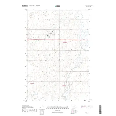
2017 Map of Bath
USGS Topo · Published 2017About this map
Bath and Bath Corner anchor this Brown County landscape, illustrating the spatial organization of rural South Dakota in the early 21st century. The settlement at Bath includes a local Po and is situated along a grid of agricultural thoroughfares like Railroad Ave. The terrain is defined by the meandering path of the James River, which winds through the eastern portion of the quadrangle, while Moccasin Creek flows across the southwestern corner. Cultural markers such as the German Cem provide genealogical value, situated north of Co Rd 21. The map reflects a blend of traditional rural sections and newer developments, evidenced by residential labels like Pintail Ave and Mallard View Dr near the town center. This survey captures a moment where water management and transport infrastructure dictate the placement of local homesteads and community hubs.
Find a feature on this map
25 named features on this map. Tap any name to fly to it.
Don’t see what you’re looking for? This feature index may not catch every label — zoom into the map to look around manually.
Map Details
Editions of this 2017 Bath Map
This is the sole edition of this map. No revisions or reprints were ever made.
Other maps of this area

1894 · Columbia
USGS Topo · 1:62,500

1895 · Aberdeen
USGS Topo · 1:125,000

1896 · Columbia
USGS Topo · 1:125,000

1952 · Columbia
USGS Topo · 1:24,000

1952 · Ordway
USGS Topo · 1:24,000

1952 · Putney
USGS Topo · 1:24,000

1953 · Stratford
USGS Topo · 1:24,000

1953 · Groton SW
USGS Topo · 1:24,000

1953 · Warner
USGS Topo · 1:24,000

1954 · Bath
USGS Topo · 1:24,000