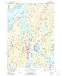
1980 Map of Bath
USGS Topo · Published 1990About this map
The maritime identity of Bath is clearly etched across this coastal landscape, where the Kennebec River meets a complex network of tidal reaches and islands. The city’s industrial and civic core is detailed with landmarks such as the Marine Museum, Morse High School, and the extensive Dry Dock facilities that speak to its shipbuilding heritage. Connecting the banks, the Carlton Br carries both road and the Maine Central rail line over the water toward Woolwich, while remnants of older transit methods like the Ferry Slips and the settlement of Days Ferry remain visible.
Find a feature on this map
107 named features on this map. Tap any name to fly to it.
Don’t see what you’re looking for? This feature index may not catch every label — zoom into the map to look around manually.
Map Details
Editions of this 1980 Bath Map
3 editions found
Other maps of this area

1892 · Gardiner
USGS Topo · 1:62,500

1893 · Wiscasset
USGS Topo · 1:62,500

1893 · Boothbay
USGS Topo · 1:62,500

1894 · Bath
USGS Topo · 1:62,500

1920 · Bath
USGS Topo · 1:62,500

1941 · Boothbay
USGS Topo · 1:62,500

1943 · Gardiner
USGS Topo · 1:62,500

1943 · Boothbay
USGS Topo · 1:62,500

1944 · Wiscasset
USGS Topo · 1:62,500

1944 · Boothbay
USGS Topo · 1:62,500