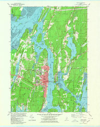
1980 Map of Bath
USGS Topo · Published 1980About this map
The shipbuilding city of Bath dominates this coastal landscape, situated along the deep waters of the Kennebec River. This 1980 survey captures the city's complex waterfront infrastructure, including its Dry Dock and proximity to the Marine Mus. The surrounding maritime geography is defined by intricate tidal passages and islands, such as Arrowsic Island and the turbulent waters of Upper Hell Gate. Historically significant cemeteries like Oak Grove Cem and Maple Grove Cem are meticulously charted near the city center, providing a vital resource for genealogists.
Find a feature on this map
95 named features on this map. Tap any name to fly to it.
Don’t see what you’re looking for? This feature index may not catch every label — zoom into the map to look around manually.
Map Details
Editions of this 1980 Bath Map
3 editions found
Other maps of this area

1892 · Gardiner
USGS Topo · 1:62,500

1893 · Wiscasset
USGS Topo · 1:62,500

1893 · Boothbay
USGS Topo · 1:62,500

1894 · Bath
USGS Topo · 1:62,500

1920 · Bath
USGS Topo · 1:62,500

1941 · Boothbay
USGS Topo · 1:62,500

1943 · Gardiner
USGS Topo · 1:62,500

1943 · Boothbay
USGS Topo · 1:62,500

1944 · Wiscasset
USGS Topo · 1:62,500

1944 · Boothbay
USGS Topo · 1:62,500