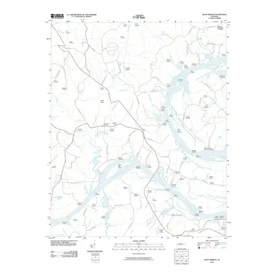
2010 Map of Bath Springs
USGS Topo · Published 2010About this map
Tennessee River navigation and the legacy of local industry define this landscape near the community of Mount Carmel. The river's broad course is marked by numerous landings that once served as vital commerce points, including Bobs Landing, Akin Landing, and Patterson Landing. Evidence of the region's 19th-century industrial past remains at Decatur Furnace, a site indicative of the iron production that once thrived in this part of the state. The interior is a mosaic of family heritage, with dozens of small burial grounds such as the Lafferty Cemetery, Simmons Cemetery, and Yarbro Cemetery dotting the ridges and hollows. The presence of the Bath Springs Post Office and the Clifton Marina underscores the shift from river-based industry to modern recreational and civic life along the banks of the Tennessee.
Find a feature on this map
135 named features on this map. Tap any name to fly to it.
Don’t see what you’re looking for? This feature index may not catch every label — zoom into the map to look around manually.
Map Details
Editions of this 2010 Bath Springs Map
This is the sole edition of this map. No revisions or reprints were ever made.
Other maps of this area

1905 · Waynesboro
USGS Topo · 1:125,000

1936 · Hookers Bend
USGS Topo · 1:24,000

1936 · Scotts Hill
USGS Topo · 1:24,000

1936 · Eagle Creek
USGS Topo · 1:24,000

1936 · Thurman
USGS Topo · 1:24,000

1936 · Olivehill
USGS Topo · 1:24,000

1936 · Bath Springs
USGS Topo · 1:24,000

1936 · Clifton
USGS Topo · 1:24,000

1936 · Perryville
USGS Topo · 1:24,000

1936 · Pope
USGS Topo · 1:24,000