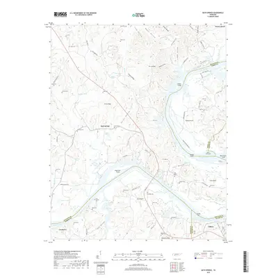
2019 Map of Bath Springs
USGS Topo · Published 2019About this map
Bath Springs and the surrounding river bottomlands define this stretch of the Tennessee River valley where the borders of Decatur, Wayne, Perry, and Hardin counties converge. The river’s winding course, forming Kentucky Lake in this reach, is punctuated by landforms like Clifton Bend and Nance Bend, while numerous small islands including Eagle Nest Island and Jeter Towhead remain prominent. The landscape is heavily dissected by narrow hollows such as Mager Hollow and Hughes Hollow, which provided the traditional routes for early settlement and family homesteads.
Find a feature on this map
104 named features on this map. Tap any name to fly to it.
Don’t see what you’re looking for? This feature index may not catch every label — zoom into the map to look around manually.
Map Details
Editions of this 2019 Bath Springs Map
This is the sole edition of this map. No revisions or reprints were ever made.
Other maps of this area

1905 · Waynesboro
USGS Topo · 1:125,000

1936 · Hookers Bend
USGS Topo · 1:24,000

1936 · Scotts Hill
USGS Topo · 1:24,000

1936 · Eagle Creek
USGS Topo · 1:24,000

1936 · Thurman
USGS Topo · 1:24,000

1936 · Olivehill
USGS Topo · 1:24,000

1936 · Bath Springs
USGS Topo · 1:24,000

1936 · Clifton
USGS Topo · 1:24,000

1936 · Perryville
USGS Topo · 1:24,000

1936 · Pope
USGS Topo · 1:24,000