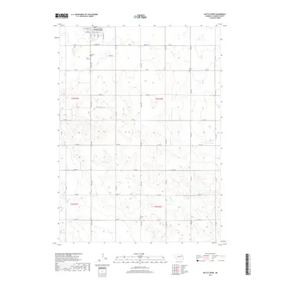
2017 Map of Battle Creek
USGS Topo · Published 2017About this map
Battle Creek sits at the northern edge of this Madison County landscape, where the town grid is defined by streets like W Herman St and S Boyer St. The surrounding countryside follows a strict section-line road system, with routes such as 546th Ave and 838 Rd cutting through the agricultural terrain. This 2017 survey reveals a landscape deeply connected to its local heritage, marked by several rural burial grounds including Union Cem, Lutheran Cem, Allbery Cem, and Fairview Cem. These sites, often positioned near section corners or along gravel roads, serve as primary genealogical anchors for the area. The hydrology is dominated by the meandering paths of Battle Cr and N Taylor Cr, which provide the only relief to the geometric precision of the township and range boundaries.
Find a feature on this map
44 named features on this map. Tap any name to fly to it.
Don’t see what you’re looking for? This feature index may not catch every label — zoom into the map to look around manually.
Map Details
Editions of this 2017 Battle Creek Map
This is the sole edition of this map. No revisions or reprints were ever made.
Other maps of this area

1955 · Sioux City
USGS Topo · 1:250,000

1955 · Fremont
USGS Topo · 1:250,000

1957 · Fremont
USGS Topo · 1:250,000

1958 · Sioux City
USGS Topo · 1:250,000

1958 · Fremont
USGS Topo · 1:250,000

1959 · Sioux City
USGS Topo · 1:250,000

1963 · Madison
USGS Topo · 1:24,000

1963 · Battle Creek
USGS Topo · 1:24,000

1963 · Pierce SE
USGS Topo · 1:24,000

1963 · Emerick
USGS Topo · 1:24,000