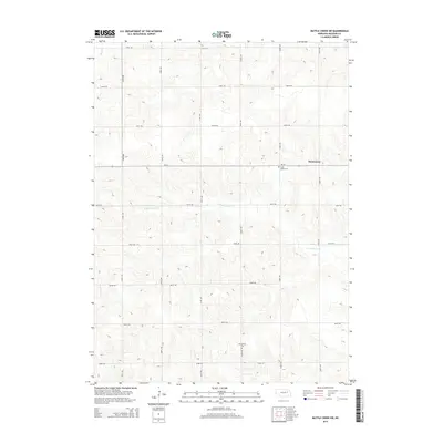
2014 Map of Battle Creek SW
USGS Topo · Published 2014About this map
The tiny settlement of Kalamazoo occupies a high point on the plains of Madison County, serving as a landmark in a landscape defined by an orderly section-line road grid. Two distinct burial grounds, Iowa Valley Cem to the south of the village and Evangelical Cem further into the rural township, provide critical points of interest for genealogists tracing early families in this agricultural region. The terrain is gently carved by small watercourses, including the headwaters of Battle Cr in the northwest and the winding path of N Fork Union Cr through the central portion. State highway Ne-32 provides the primary east-west corridor, connecting these remote farmsteads to the wider Nebraska plains during the early 21st century.
Find a feature on this map
20 named features on this map. Tap any name to fly to it.
Don’t see what you’re looking for? This feature index may not catch every label — zoom into the map to look around manually.
Map Details
Editions of this 2014 Battle Creek SW Map
This is the sole edition of this map. No revisions or reprints were ever made.
Other maps of this area

1955 · Fremont
USGS Topo · 1:250,000

1957 · Fremont
USGS Topo · 1:250,000

1958 · Fremont
USGS Topo · 1:250,000

1963 · Battle Creek
USGS Topo · 1:24,000

1963 · Emerick
USGS Topo · 1:24,000

1963 · Closter SE
USGS Topo · 1:24,000
1963 · Closter NE
USGS Topo · 1:24,000

1963 · Battle Creek SE
USGS Topo · 1:24,000

1963 · Battle Creek SW
USGS Topo · 1:24,000
1966 · Newman Grove
USGS Topo · 1:24,000