
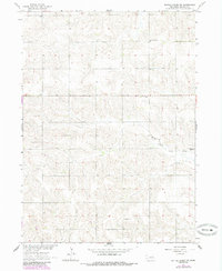
1963 Map of Battle Creek SW
USGS Topo · Published 1964About this map
Rural Madison County, Nebraska, is defined here by a dense network of early 1960s section roads and the winding paths of North Fork Union Creek and Union Creek. The landscape reflects a deeply established agricultural community, anchored by the St Francis de Sales Ch and small rural education centers such as Olson Sch and School No 28. The distribution of family-named schoolhouses like Chloe Sch and Solso Sch suggests a period when local townships—including Emerick, Schoolcraft, Shell Creek, and Kalamazoo—still maintained distinct civic identities through their neighborhood schools and cemeteries. This survey captures the transition of the Missouri River Basin's development, documenting the precise locations of the Iowa Valley Cem and Evangelical Cem before further consolidation of rural districts.
Find a feature on this map
16 named features on this map. Tap any name to fly to it.
Don’t see what you’re looking for? This feature index may not catch every label — zoom into the map to look around manually.
Map Details
Editions of this 1963 Battle Creek SW Map
2 editions found
Other maps of this area

1955 · Fremont
USGS Topo · 1:250,000

1957 · Fremont
USGS Topo · 1:250,000

1958 · Fremont
USGS Topo · 1:250,000

1963 · Battle Creek
USGS Topo · 1:24,000

1963 · Emerick
USGS Topo · 1:24,000

1963 · Closter SE
USGS Topo · 1:24,000
1963 · Closter NE
USGS Topo · 1:24,000

1963 · Battle Creek SE
USGS Topo · 1:24,000
1966 · Newman Grove
USGS Topo · 1:24,000
1966 · Lindsay
USGS Topo · 1:24,000