
1963 Map of Battle Creek SE
USGS Topo · Published 1964About this map
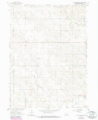
Green Garden, Fairview, and Kalamazoo townships comprise the heart of this rural Madison County landscape as it appeared in the early 1960s. The map illustrates a dense network of local education and faith-based landmarks essential to Nebraska's mid-century rural communities, including St John Sch and various district schoolhouses such as School No 15, School No 42, and School No 7. The hydrology is defined by the wandering paths of Taylor Creek and the North Fork Union Creek, which feed into the primary Union Creek channel. This survey documents the specific placement of local burial sites including Green Garden Cem and Kalamazoo Cem, providing a detailed look at the rural settlement patterns before many of these smaller country schools and community focal points were consolidated or altered by modern agricultural expansion.
Find a feature on this map
14 named features on this map. Tap any name to fly to it.
Don’t see what you’re looking for? This feature index may not catch every label — zoom into the map to look around manually.
Map Details
Editions of this 1963 Battle Creek SE Map
2 editions found
Other maps of this area

1955 · Fremont
USGS Topo · 1:250,000

1957 · Fremont
USGS Topo · 1:250,000

1958 · Fremont
USGS Topo · 1:250,000

1963 · Madison
USGS Topo · 1:24,000

1963 · Battle Creek
USGS Topo · 1:24,000

1963 · Emerick
USGS Topo · 1:24,000
1963 · Enola
USGS Topo · 1:24,000

1963 · Battle Creek SW
USGS Topo · 1:24,000
1966 · Lindsay
USGS Topo · 1:24,000
1966 · Cornlea
USGS Topo · 1:24,000