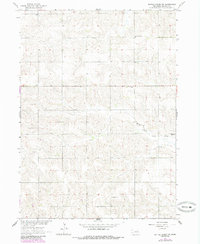
1963 Map of Battle Creek SW
USGS Topo · Published 1985About this map
North Fork Union Creek winds through the rural landscape of Madison County, carving a path through the rolling agricultural uplands of northeast Nebraska. This 1963 survey, later updated with photorevisions in the early 1980s, reveals a network of country schoolhouses and religious landmarks that served the surrounding farmstead families. Centers of local community life are clearly marked, including the St Francis de Sales Ch and educational outposts such as Chloe Sch and Jenkins Sch. The distribution of these features across the township lines suggests a period when small-scale, decentralized institutions were still the heart of the rural prairie economy. Genealogists can trace family heritage through burial grounds like Iowa Valley Cem and Evangelical Cem, which anchor the historical geography of this prairie terrain.
Find a feature on this map
7 named features on this map. Tap any name to fly to it.
Don’t see what you’re looking for? This feature index may not catch every label — zoom into the map to look around manually.
Map Details
Editions of this 1963 Battle Creek SW Map
2 editions found
Other maps of this area

1955 · Fremont
USGS Topo · 1:250,000

1957 · Fremont
USGS Topo · 1:250,000

1958 · Fremont
USGS Topo · 1:250,000

1963 · Battle Creek
USGS Topo · 1:24,000

1963 · Emerick
USGS Topo · 1:24,000

1963 · Closter SE
USGS Topo · 1:24,000
1963 · Closter NE
USGS Topo · 1:24,000

1963 · Battle Creek SE
USGS Topo · 1:24,000

1963 · Battle Creek SW
USGS Topo · 1:24,000
1966 · Newman Grove
USGS Topo · 1:24,000