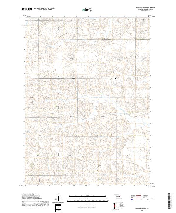
2021 Map of Battle Creek SW
USGS Topo · Published 2021About this map
The drainage of N Fork Union Cr and Battle Creek defines this section of Madison County, where the agricultural landscape is carved into a series of rolling uplands and creek bottoms. The map reveals the rigid organization of the Public Land Survey System, with the terrain divided by the intersections of t22n r4w and t21n r3w. Cultural landmarks are sparse but significant for local history, notably the Iowa Valley Cem and the Evangelical Cem, which serve as the primary markers of the area's early settlement. A network of section-line roads, including 830th Rd and 542nd Ave, provides a window into the rural infrastructure of the early twenty-first century, linking isolated farmsteads across the Nebraska plains.
Find a feature on this map
22 named features on this map. Tap any name to fly to it.
Don’t see what you’re looking for? This feature index may not catch every label — zoom into the map to look around manually.
Map Details
Editions of this 2021 Battle Creek SW Map
This is the sole edition of this map. No revisions or reprints were ever made.
Other maps of this area

1955 · Fremont
USGS Topo · 1:250,000

1957 · Fremont
USGS Topo · 1:250,000

1958 · Fremont
USGS Topo · 1:250,000

1963 · Battle Creek
USGS Topo · 1:24,000

1963 · Emerick
USGS Topo · 1:24,000

1963 · Closter SE
USGS Topo · 1:24,000
1963 · Closter NE
USGS Topo · 1:24,000

1963 · Battle Creek SE
USGS Topo · 1:24,000

1963 · Battle Creek SW
USGS Topo · 1:24,000
1966 · Newman Grove
USGS Topo · 1:24,000