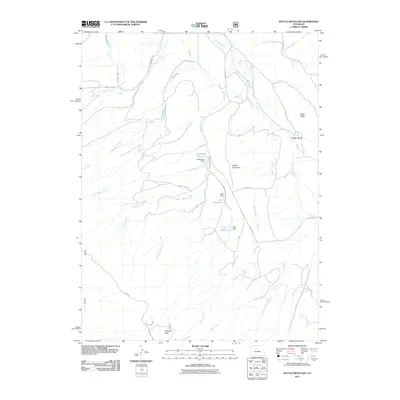
2011 Map of Battle Mountain
USGS Topo · Published 2011About this map
Battle Mountain and Williams Peak anchor this high-elevation landscape in Summit County, defined by a complex network of water management features and seasonal drainage. The map highlights a series of small-scale impoundments including Langholen Reservoir, Cole Reservoir, and Dale Reservoir, each supported by its respective Langholen Dam, Cole Dam, and Dale Dam. These structures suggest a legacy of water storage for local use, potentially linked to the area's agricultural or ranching history.
Find a feature on this map
34 named features on this map. Tap any name to fly to it.
Don’t see what you’re looking for? This feature index may not catch every label — zoom into the map to look around manually.
Map Details
Editions of this 2011 Battle Mountain Map
This is the sole edition of this map. No revisions or reprints were ever made.
Other maps of this area

1933 · Mt. Powell
USGS Topo · 1:48,000

1933 · Ute Peak
USGS Topo · 1:62,500

1937 · Ute Peak
USGS Topo · 1:62,500

1940 · Mount Powell
USGS Topo · 1:62,500

1954 · Craig
USGS Topo · 1:250,000

1956 · Kremmling
USGS Topo · 1:62,500

1957 · Craig
USGS Topo · 1:250,000

1957 · Hot Sulphur Springs
USGS Topo · 1:62,500

1957 · Leadville
USGS Topo · 1:250,000

1958 · Craig
USGS Topo · 1:250,000