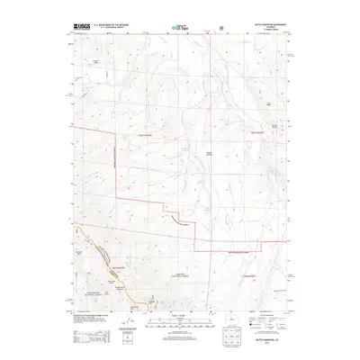
2013 Map of Battle Mountain
USGS Topo · Published 2013About this map
Battle Mountain dominates this high-altitude landscape where the headwaters of the Williams Fork and several local tributaries carve through the Arapaho National Forest. The map documents a complex drainage system essential for water management, featuring the Big Lake Ditch and several high-country basins such as Langholen Reservoir and Cole Reservoir. To the southwest, the terrain rises sharply toward the Williams Fork Mountains and Williams Peak, marking a significant topographical transition near the Williams Divide. This area serves as a critical boundary between the Arapaho and White River National Forest, characterized by numerous named gulches like Johnson Gulch and Cow Camp Gulch that follow the steep descent toward the valley floors. Historical land use is evidenced by the named ridge lines and the winding path of Williams Peak Trail 26, reflecting a region defined by its watershed and forest management.
Find a feature on this map
37 named features on this map. Tap any name to fly to it.
Don’t see what you’re looking for? This feature index may not catch every label — zoom into the map to look around manually.
Map Details
Editions of this 2013 Battle Mountain Map
This is the sole edition of this map. No revisions or reprints were ever made.
Other maps of this area

1933 · Mt. Powell
USGS Topo · 1:48,000

1933 · Ute Peak
USGS Topo · 1:62,500

1937 · Ute Peak
USGS Topo · 1:62,500

1940 · Mount Powell
USGS Topo · 1:62,500

1954 · Craig
USGS Topo · 1:250,000

1956 · Kremmling
USGS Topo · 1:62,500

1957 · Craig
USGS Topo · 1:250,000

1957 · Hot Sulphur Springs
USGS Topo · 1:62,500

1957 · Leadville
USGS Topo · 1:250,000

1958 · Craig
USGS Topo · 1:250,000