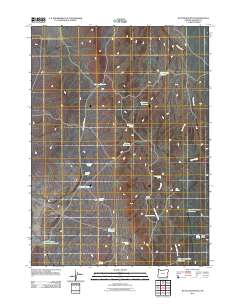
2011 Map of Battle Mountain
USGS Topo · Published 2011About this map
Battle Mountain dominates this portion of Malheur County, where a complex network of springs and reservoirs supports the arid rangeland economy. Water management is the primary defining characteristic of the landscape, illustrated by numerous named catchments such as Harper Reservoir, Big Arrow Reservoir, and Summit Reservoir. These features, alongside isolated water sources like Portuguese Spring and Dead Cow Spring, suggest a history of seasonal grazing and livestock movement through the high desert. Battle Creek Ranch Rd provides the primary access through this territory, tracing a path near Battle Creek and the headwaters of Rattlesnake Creek. The map provides a precise record of these vital water points, which remain central to the survival of the local ranching operations in this remote corner of Oregon.
Find a feature on this map
25 named features on this map. Tap any name to fly to it.
Don’t see what you’re looking for? This feature index may not catch every label — zoom into the map to look around manually.
Map Details
Editions of this 2011 Battle Mountain Map
This is the sole edition of this map. No revisions or reprints were ever made.
Other maps of this area

1955 · Jordan Valley
USGS Topo · 1:250,000

1957 · Jordan Valley
USGS Topo · 1:250,000

1958 · Jordan Valley
USGS Topo · 1:250,000

1982 · Battle Mtn
USGS Topo · 1:24,000

1982 · Rattlesnake Canyon
USGS Topo · 1:24,000
1982 · Bowden Waterhole
USGS Topo · 1:24,000
1982 · Jackson Summit
USGS Topo · 1:24,000
1982 · Grasshopper Flat North
USGS Topo · 1:24,000
1982 · Basque
USGS Topo · 1:24,000
1982 · Battle Creek Ranch
USGS Topo · 1:24,000