
1952 Map of Battle Mountain
USGS Topo · Published 1954About this map
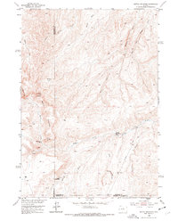
Bates Battlefield lies at the heart of this mid-century survey, marking a site of significant cultural and military history at the foot of Battle Mountain. The landscape is defined by the drainage network of Nowood Creek and Bates Creek, where remote cattle operations like the Orchard Bates Creek Ranch and Rate Homestead established a foothold in the arid Wyoming basin. The terrain rises toward Hawks Butte, while the No Wood Road provides the primary corridor through this sparsely populated territory.
Find a feature on this map
19 named features on this map. Tap any name to fly to it.
Don’t see what you’re looking for? This feature index may not catch every label — zoom into the map to look around manually.
Map Details
Editions of this 1952 Battle Mountain Map
2 editions found
Other maps of this area

1952 · Cottonwood Pass
USGS Topo · 1:24,000

1952 · Sioux Pass
USGS Topo · 1:24,000

1952 · Arapahoe Butte
USGS Topo · 1:24,000

1952 · Bull Mountain
USGS Topo · 1:24,000

1955 · Arminto
USGS Topo · 1:250,000

1958 · Arminto
USGS Topo · 1:250,000

1962 · Arminto
USGS Topo · 1:250,000

1966 · Sand Point
USGS Topo · 1:24,000

1966 · Bader Draw
USGS Topo · 1:24,000
1967 · Cornell Gulch
USGS Topo · 1:24,000