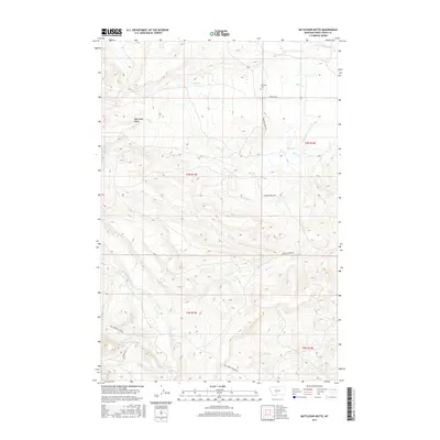
2017 Map of Battleship Butte
USGS Topo · Published 2017About this map
Battleship Butte stands as a prominent landmark in this ranching landscape of Sweet Grass County, Montana. The terrain is defined by an intricate network of waterways, including Big Timber Cr, Wheeler Cr, and Otter Cr, which flow through the foothills of the Crazy Mountains. The presence of the Anderson-Vose Ditch indicates the historical importance of water management for local agriculture in this semi-arid environment. Genealogy and local history researchers will find the Melville Cem near the junction of Melville Rd and Wheeler Creek Rd, serving as a focal point for the early settlement of the area. The road network, featuring Big Timber Canyon Rd and Grosfield Ln, traces the paths used by homesteaders to navigate the varied elevation between the creek bottoms and the higher ridges.
Find a feature on this map
24 named features on this map. Tap any name to fly to it.
Don’t see what you’re looking for? This feature index may not catch every label — zoom into the map to look around manually.
Map Details
Editions of this 2017 Battleship Butte Map
This is the sole edition of this map. No revisions or reprints were ever made.
Other maps of this area

1886 · Little Belt Mts.
USGS Topo · 1:250,000

1889 · Big Snowy Mountain
USGS Topo · 1:250,000

1891 · Livingston
USGS Topo · 1:250,000

1891 · Big Timber
USGS Topo · 1:125,000

1893 · Livingston
USGS Topo · 1:250,000

1893 · Big Snowy Mountain
USGS Topo · 1:250,000

1893 · Big Timber
USGS Topo · 1:125,000

1894 · Little Belt Mts.
USGS Topo · 1:250,000

1897 · Little Belt Mts.
USGS Topo · 1:250,000

1898 · Little Belt Mts.
USGS Topo · 1:250,000