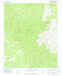
1974 Map of Battleship Butte
USGS Topo · Published 1977About this map
The Bradshaw Mountains dominate this mid-1970s survey, revealing a landscape defined by mining history and cattle ranching within the Prescott National Forest. Remote sites such as Goodwin and Hooper represent the remnants of earlier activity along the Senator Highway, a historic transit corridor through the high country. Small-scale mining is evident through features like the Bodie Mine and Yankee Boy Mine, while the presence of the Old Trap Corral and the McNary Place points to the area's agricultural heritage. The terrain is deeply incised by drainages such as Ash Creek Canyon and Maidenhead Canyon, which provide essential water sources in this arid environment through numerous named springs like Bodie Spring and Arrastra Spring.
Find a feature on this map
64 named features on this map. Tap any name to fly to it.
Don’t see what you’re looking for? This feature index may not catch every label — zoom into the map to look around manually.
Map Details
Editions of this 1974 Battleship Butte Map
3 editions found
Other maps of this area

1887 · Prescott
USGS Topo · 1:250,000

1892 · Prescott
USGS Topo · 1:250,000

1903 · Bradshaw Mountains
USGS Topo · 1:125,000

1903 · Congress
USGS Topo · 1:125,000

1904 · Congress
USGS Topo · 1:125,000

1947 · Crown King
USGS Topo · 1:62,500

1947 · Mt. Union
USGS Topo · 1:62,500

1947 · Kirkland
USGS Topo · 1:62,500

1947 · Wagoner
USGS Topo · 1:62,500

1948 · Crown King
USGS Topo · 1:63,360