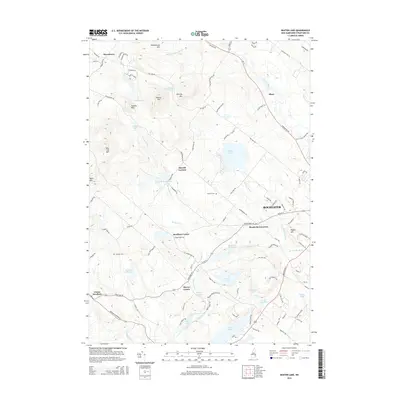
2015 Map of Baxter Lake
USGS Topo · Published 2015About this map
Blue Job Mtn and a series of prominent peaks including Hussey Mtn and Chesley Mtn define the western uplands of this Strafford County landscape. This 2015 survey illustrates a rural-residential network structured around historical junctions like Strafford Corner, Berrys Corner, and Meaderboro Corner. The drainage pattern is complex, with the Berrys River feeding the Berrys River Reservoir and Ayers Pond in the south, while the Cocheco River clips the northeastern corner near Place. Water resources are a central theme of the topography, evidenced by the Rochester Reservoir and the sizable Baxter Lake. Genealogists and local historians can locate small family burying grounds such as Kimball Cem near the lake or Johnson Cem further west. The map also traces established thoroughfares like Ten Rod RD and Farmington RD, which connect these small communities to the larger hub of Rochester in the southeast.
Find a feature on this map
111 named features on this map. Tap any name to fly to it.
Don’t see what you’re looking for? This feature index may not catch every label — zoom into the map to look around manually.
Map Details
Editions of this 2015 Baxter Lake Map
This is the sole edition of this map. No revisions or reprints were ever made.
Other maps of this area

1891 · Berwick
USGS Topo · 1:62,500

1893 · Dover
USGS Topo · 1:62,500

1893 · Berwick
USGS Topo · 1:62,500

1916 · Dover
USGS Topo · 1:62,500

1917 · Mt. Pawtuckaway
USGS Topo · 1:62,500

1918 · Dover
USGS Topo · 1:62,500

1919 · Mt. Pawtuckaway
USGS Topo · 1:62,500

1919 · Alton
USGS Topo · 1:62,500

1933 · Berwick
USGS Topo · 1:48,000

1937 · Berwick
USGS Topo · 1:62,500