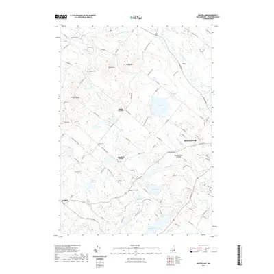
2021 Map of Baxter Lake
USGS Topo · Published 2021About this map
Strafford Corner and its surrounding rural hamlets are centered in a landscape of dramatic topography and abundant water sources. The area is defined by the high elevations of Blue Job Mtn and Hussey Mtn, which overlook a network of valley streams including the Berrys River and Mad River. This modern survey reveals a persistent pattern of rural New England settlement, where family names and crossroads communities like Merrill Corners and Meaderboro Corner anchor the geography. Genealogy researchers will find numerous small burial sites preserved, from Crown Point Cem to Stanton Cem. Large water bodies like Baxter Lake and Ayers Pond dominate the lowlands, while the Isinglass River flows through the southern portion of the quadrangle. The map captures the meeting of dense forest terrain and the spreading road networks near Rochester.
Find a feature on this map
106 named features on this map. Tap any name to fly to it.
Don’t see what you’re looking for? This feature index may not catch every label — zoom into the map to look around manually.
Map Details
Editions of this 2021 Baxter Lake Map
This is the sole edition of this map. No revisions or reprints were ever made.
Other maps of this area

1891 · Berwick
USGS Topo · 1:62,500

1893 · Dover
USGS Topo · 1:62,500

1893 · Berwick
USGS Topo · 1:62,500

1916 · Dover
USGS Topo · 1:62,500

1917 · Mt. Pawtuckaway
USGS Topo · 1:62,500

1918 · Dover
USGS Topo · 1:62,500

1919 · Mt. Pawtuckaway
USGS Topo · 1:62,500

1919 · Alton
USGS Topo · 1:62,500

1933 · Berwick
USGS Topo · 1:48,000

1937 · Berwick
USGS Topo · 1:62,500