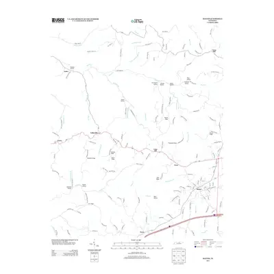
2013 Map of Baxter
USGS Topo · Published 2013About this map
Baxter serves as the primary hub in this central Tennessee landscape, where the town's grid meets the headwaters of Mine Lick Cr. The topography is defined by a dense network of ridges and hollows that historically dictated settlement patterns and road placements. To the north and west, smaller communities like Lafayette, Gentry, and Sadler are situated along winding routes such as Martin Creek Rd, following the natural contours of the land. High ground features like Goolsby Ridge and Bruce Ridge overlook a complex drainage system including Indian Cr and McBroom Br. This 2013 survey illustrates the enduring rural character of the region, where family names are etched into the geography through landmarks like Hatfield Hollow and Carrington Hollow. The map provides a clear view of the transition from the concentrated residential streets of Baxter to the scattered homesteads of Boma and Union Hill.
Find a feature on this map
144 named features on this map. Tap any name to fly to it.
Don’t see what you’re looking for? This feature index may not catch every label — zoom into the map to look around manually.
Map Details
Editions of this 2013 Baxter Map
This is the sole edition of this map. No revisions or reprints were ever made.
Other maps of this area

1925 · Gainesboro
USGS Topo · 1:62,500

1928 · Gordonsville
USGS Topo · 1:62,500

1929 · Gainesboro
USGS Topo · 1:62,500

1932 · Carthage
USGS Topo · 1:62,500

1942 · Statesville
USGS Topo · 1:100,000

1943 · Cookeville
USGS Topo · 1:100,000

1944 · Cookeville
USGS Topo · 1:100,000

1953 · Cookeville West
USGS Topo · 1:24,000

1955 · Baxter
USGS Topo · 1:24,000
1956 · Burgess Falls
USGS Topo · 1:24,000