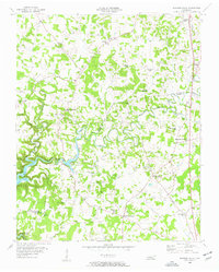
1956 Map of Burgess Falls
USGS Topo · Published 1957About this map
The Falling Water River carves a winding path across the boundary of Putnam Co White Co, anchoring a mid-century rural landscape defined by small agrarian communities and religious life. This mid-1950s survey documents the area just as the Center Hill Reservoir began to influence the local topography, featuring the notable Burgess Falls and the adjacent Burgess Falls Lake.
Find a feature on this map
47 named features on this map. Tap any name to fly to it.
Don’t see what you’re looking for? This feature index may not catch every label — zoom into the map to look around manually.
Map Details
Editions of this 1956 Burgess Falls Map
4 editions found
Other maps of this area

1892 · Pikeville
USGS Topo · 1:125,000

1893 · Mc Minnville
USGS Topo · 1:125,000

1895 · Mc Minnville
USGS Topo · 1:125,000

1895 · Pikeville
USGS Topo · 1:125,000

1897 · Standingstone
USGS Topo · 1:125,000

1898 · Standingstone
USGS Topo · 1:125,000

1943 · Cookeville
USGS Topo · 1:100,000

1944 · Cookeville
USGS Topo · 1:100,000

1953 · Chattanooga
USGS Topo · 1:250,000

1953 · Cookeville East
USGS Topo · 1:24,000