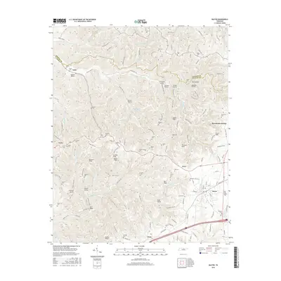
2016 Map of Baxter
USGS Topo · Published 2016About this map
Baxter serves as a central hub in this Putnam County landscape, where the plateau terrain is deeply carved by watercourses like Mine Lick Cr and Maxwell Br. The map reveals a dense network of family-named landmarks and rural settlements, including Bloomington Springs, Ensor, and Boma, each connected by winding routes like Martin Creek Rd. The high density of small family burial grounds, such as Whitaker Cem, McReynolds Cem, and Pippin Cem, offers a detailed spatial record for genealogists tracing local lineage through the hollows and ridges.
Find a feature on this map
152 named features on this map. Tap any name to fly to it.
Don’t see what you’re looking for? This feature index may not catch every label — zoom into the map to look around manually.
Map Details
Editions of this 2016 Baxter Map
This is the sole edition of this map. No revisions or reprints were ever made.
Other maps of this area

1925 · Gainesboro
USGS Topo · 1:62,500

1928 · Gordonsville
USGS Topo · 1:62,500

1929 · Gainesboro
USGS Topo · 1:62,500

1932 · Carthage
USGS Topo · 1:62,500

1942 · Statesville
USGS Topo · 1:100,000

1943 · Cookeville
USGS Topo · 1:100,000

1944 · Cookeville
USGS Topo · 1:100,000

1953 · Cookeville West
USGS Topo · 1:24,000

1955 · Baxter
USGS Topo · 1:24,000
1956 · Burgess Falls
USGS Topo · 1:24,000