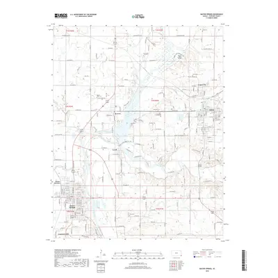
2018 Map of Baxter Springs
USGS Topo · Published 2018About this map
Spring River and its major tributaries, including Shoal Creek and Brush Creek, dominate this corner of Cherokee County. The landscape reflects a legacy of crossroads and waterpower, anchored by the substantial settlements of Baxter Springs and Galena. In the northern reaches, the Boston Mills Bridge spans the river near the Boston Mills - Cox Cem, marking an area where small-scale industry once centered around the waterway. The map captures the dense street grids of the mining and commerce centers at Empire City and Galena, which contrast with the unincorporated feel of places like Riverton and Lowell. For genealogists, the distribution of family and community burial grounds such as Quaker Valley Cem, Pence Cem, and Stevenson Cem provides critical points for locating early residents along the historic corridors of Old US Hwy 66 and the BNSF Railway.
Find a feature on this map
84 named features on this map. Tap any name to fly to it.
Don’t see what you’re looking for? This feature index may not catch every label — zoom into the map to look around manually.
Map Details
Editions of this 2018 Baxter Springs Map
This is the sole edition of this map. No revisions or reprints were ever made.
Other maps of this area

1886 · Joplin
USGS Topo · 1:125,000

1894 · Joplin
USGS Topo · 1:125,000

1907 · Wyandotte
USGS Topo · 1:125,000

1909 · Wyandotte
USGS Topo · 1:125,000

1918 · Columbus
USGS Topo · 1:62,500

1947 · Joplin
USGS Topo · 1:250,000

1949 · Joplin
USGS Topo · 1:250,000

1949 · Racine
USGS Topo · 1:24,000

1950 · Racine
USGS Topo · 1:24,000

1954 · Tulsa
USGS Topo · 1:250,000