
2023 Map of Bay City
USGS Topo · Published 2023About this map
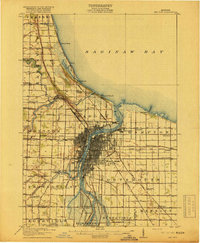
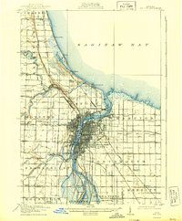
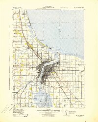
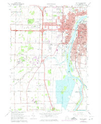
The Saginaw River serves as the central artery for this contemporary view of Bay City, Michigan, where the waterway's industrial legacy meets modern educational and infrastructure hubs. This geography is defined by the river’s branching channels and islands, including Middle Ground, Stony Island, and Skull Island, which separate the main city center from the western developments. The landscape transitions from the urban grid of the riverfront to academic campuses like Delta College and Saginaw Valley State University to the southwest.
Find a feature on this map
49 named features on this map. Tap any name to fly to it.
Don’t see what you’re looking for? This feature index may not catch every label — zoom into the map to look around manually.
Map Details
Editions of this 2023 Bay City Map
This is the sole edition of this map. No revisions or reprints were ever made.
Historical Maps of Zilwaukee Township Through Time
6 maps found

Featured Locations
- Bay City, MI
- Frankenlust Township, MI
- Kochville Township, MI
- Buena Vista Charter Township, MI
- Kochville, Kochville Township