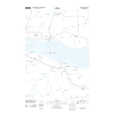
2013 Map of Bay City
USGS Topo · Published 2013About this map
Lake Pepin dominates the center of this landscape, where the Mississippi River widens along the border between Wisconsin and Minnesota. On the northern shore, the village of Bay City sits at the base of the bluffs near the mouth of Isabelle Cr, while the community of Esdaile lies further inland to the north. The terrain is defined by dramatic elevation shifts, from the low-lying waters of Goose Lake and Dead Slough Lake to the heights of Jackson Bluff and Rattlesnake Bluff.
Find a feature on this map
78 named features on this map. Tap any name to fly to it.
Don’t see what you’re looking for? This feature index may not catch every label — zoom into the map to look around manually.
Map Details
Editions of this 2013 Bay City Map
This is the sole edition of this map. No revisions or reprints were ever made.
Other maps of this area

1940 · Maiden Rock
USGS Topo · 1:62,500

1944 · Red Wing
USGS Topo · 1:62,500

1950 · Maiden Rock
USGS Topo · 1:62,500

1951 · Lake City
USGS Topo · 1:62,500

1952 · Red Wing
USGS Topo · 1:62,500

1953 · Saint Paul
USGS Topo · 1:250,000

1959 · Saint Paul
USGS Topo · 1:250,000

1968 · Goodhue East
USGS Topo · 1:24,000
1974 · Lake City NW
USGS Topo · 1:24,000
1974 · Lake City
USGS Topo · 1:24,000