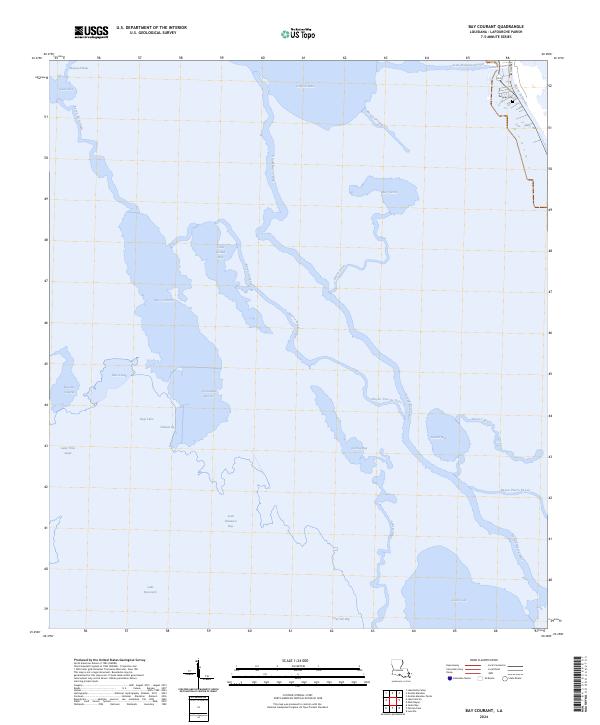
2024 Map of Bay Courant
USGS Topo · Published 2024About this map
Bayou Lafourche defines the northeastern corner of this coastal landscape, where the only significant road infrastructure, S Bayou Dr, follows the high ground along the channel. This area preserves a fragile network of marsh and open water, characterized by major basins like Catfish Lake, Little Lake, and Lake Raccourci. The complex hydrology is marked by an intricate system of passages such as Chinois Pass and Pass a Jean, which connect larger bodies like Bay Courant to smaller interior bayous.
Find a feature on this map
31 named features on this map. Tap any name to fly to it.
Don’t see what you’re looking for? This feature index may not catch every label — zoom into the map to look around manually.
Map Details
Editions of this 2024 Bay Courant Map
This is the sole edition of this map. No revisions or reprints were ever made.
Other maps of this area

1892 · Cheniere Caminada
USGS Topo · 1:62,500

1892 · Creole
USGS Topo · 1:62,500

1894 · Timbalier
USGS Topo · 1:62,500

1894 · Lake Felicity
USGS Topo · 1:62,500

1935 · Viguerie Canal
USGS Topo · 1:31,680

1935 · Bay Courant
USGS Topo · 1:31,680

1935 · Golden Meadow
USGS Topo · 1:31,680

1935 · Pelican Pass
USGS Topo · 1:31,680

1935 · Mink Bayou
USGS Topo · 1:31,680

1935 · Leeville
USGS Topo · 1:31,680