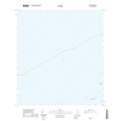
2021 Map of Bay Keys
USGS Topo · Published 2021About this map
The Intracoastal Waterway cuts a diagonal path through the open waters of the Gulf of Mexico in this marine-focused survey of Monroe County. Located in the shallow backcountry of the Florida Keys, the area is defined by complex submerged topography and a few small mangrove landmasses. Bay Keys and Cayo Agua represent the primary emergent land in this aquatic landscape, providing essential navigation points for mariners. The map highlights the intricate network of natural passages that facilitate movement through the shallows, including the Bluefish Channel and Calda Channel. These waters have long been vital for local transit and fishing, with the East Harbor Key Channel and West Harbor Key Channel marking deep-water routes around the surrounding keys. The lack of terrestrial development emphasizes the natural state of these islands and their importance to the coastal ecology of the lower Florida Keys.
Find a feature on this map
12 named features on this map. Tap any name to fly to it.
Don’t see what you’re looking for? This feature index may not catch every label — zoom into the map to look around manually.
Map Details
Editions of this 2021 Bay Keys Map
This is the sole edition of this map. No revisions or reprints were ever made.
Other maps of this area

1921 · Sugar Loaf Key
USGS Topo · 1:62,500

1921 · Key West
USGS Topo · 1:62,500

1943 · Bay Keys
USGS Topo · 1:24,000

1943 · Boca Chica
USGS Topo · 1:24,000

1943 · Key West
USGS Topo · 1:24,000

1943 · Snipe Keys
USGS Topo · 1:24,000

1943 · Cottrell Key
USGS Topo · 1:24,000

1962 · Key West
USGS Topo · 1:24,000

1963 · Cottrell Key
USGS Topo · 1:24,000

1971 · Key West
USGS Topo · 1:24,000