
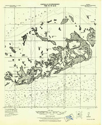
1921 Map of Sugar Loaf Key
USGS Topo · Published 1921About this map
Sugarloaf Key and its surrounding archipelago define this early 20th-century coastal survey, produced under the direction of Col. W. M. Black for the Army Corps of Engineers. This maritime landscape is a complex network of mangrove-fringed islands and shallow waterways, where tidal fluctuations of less than two feet dictate the navigability of the Boca Chica Channel and Saddle Bunch Harbor. The map records the intricate geography of the Florida Keys as they appeared before major modern development, capturing the original footprint of features like Cudjoe Key and the sprawling Snipe Keys.
Find a feature on this map
49 named features on this map. Tap any name to fly to it.
Don’t see what you’re looking for? This feature index may not catch every label — zoom into the map to look around manually.
Map Details
Editions of this 1921 Sugar Loaf Key Map
2 editions found
Other maps of this area

1921 · Key West
USGS Topo · 1:62,500

1943 · Bay Keys
USGS Topo · 1:24,000

1943 · Saddlebunch Keys
USGS Topo · 1:24,000

1943 · Boca Chica
USGS Topo · 1:24,000

1943 · Key West
USGS Topo · 1:24,000

1943 · Snipe Keys
USGS Topo · 1:24,000

1943 · Sugarloaf Key
USGS Topo · 1:24,000

1962 · Key West
USGS Topo · 1:24,000

1968 · Saddlebunch Keys
USGS Topo · 1:24,000

1971 · Key West
USGS Topo · 1:24,000