
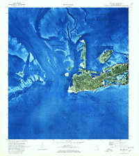
1971 Map of Key West
USGS Topo · Published 1973About this map
Key West appears in high detail during the early 1970s, captured at a moment of significant infrastructure development and military activity. This orthophotomap blends aerial photography with traditional survey data, revealing the dense urban grid of the city alongside prominent landmarks like the City Cemetery, Mallory Dock, and the historic coastal defense at Fort Taylor. Beyond the main city streets, the map details the expanding footprint of the Key West International Airport and several large U S Naval Reservations situated on Fleming Key and Stock Island.
Find a feature on this map
33 named features on this map. Tap any name to fly to it.
Don’t see what you’re looking for? This feature index may not catch every label — zoom into the map to look around manually.
Map Details
Editions of this 1971 Key West Map
2 editions found
Other maps of this area

1921 · Sugar Loaf Key
USGS Topo · 1:62,500

1921 · Key West
USGS Topo · 1:62,500

1943 · Bay Keys
USGS Topo · 1:24,000

1943 · Boca Chica
USGS Topo · 1:24,000

1943 · Key West
USGS Topo · 1:24,000

1943 · Snipe Keys
USGS Topo · 1:24,000

1943 · Cottrell Key
USGS Topo · 1:24,000

1962 · Key West
USGS Topo · 1:24,000

1963 · Cottrell Key
USGS Topo · 1:24,000
1971 · Boca Chica Key
USGS Topo · 1:24,000