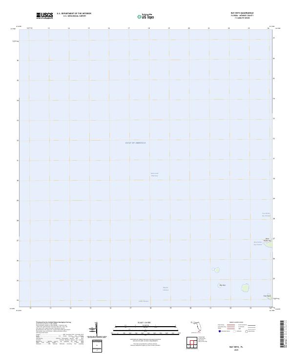
2025 Map of Bay Keys
USGS Topo · Published 2025About this map
Gulf of America waters dominate this coastal survey of the lower Florida Keys, illustrating a landscape defined by shallow flats and narrow tidal passages. Small mangrove outcroppings like Bay Keys, West Harbor Key, and Cayo Agua break the surface in the southeastern quadrant, serving as vital landmarks for local navigation in Monroe County. The map details a complex network of maritime paths, including the well-traveled Intracoastal Waterway and specialized local routes such as Bluefish Channel and Calda Channel. This charting reveals the intricate hydrography of the backcountry, where the shifting boundaries between land and sea are mediated by named flows like East Harbor Key Channel and West Harbor Key Channel.
Find a feature on this map
9 named features on this map. Tap any name to fly to it.
Don’t see what you’re looking for? This feature index may not catch every label — zoom into the map to look around manually.
Map Details
Editions of this 2025 Bay Keys Map
This is the sole edition of this map. No revisions or reprints were ever made.
Other maps of this area

1921 · Sugar Loaf Key
USGS Topo · 1:62,500

1921 · Key West
USGS Topo · 1:62,500

1943 · Bay Keys
USGS Topo · 1:24,000

1943 · Boca Chica
USGS Topo · 1:24,000

1943 · Key West
USGS Topo · 1:24,000

1943 · Snipe Keys
USGS Topo · 1:24,000

1943 · Cottrell Key
USGS Topo · 1:24,000

1962 · Key West
USGS Topo · 1:24,000

1963 · Cottrell Key
USGS Topo · 1:24,000

1971 · Key West
USGS Topo · 1:24,000