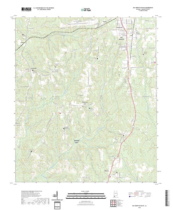
2024 Map of Bay Minette South
USGS Topo · Published 2024About this map
Bay Minette stands as the primary hub in this central Baldwin County landscape, where the town's southern edge meets a network of timbered creek bottoms and small farming communities. To the south, the settlement of Stapleton and the historic junctions at Whitehouse Forks anchor a region defined by family heritage, evidenced by numerous small burial grounds like the Hall Family Graveyard and the John H White Family Cem. The terrain is drained by a system of waterways including Whitehouse Creek and the meandering Bay Minette Creek, which carve through the elevations toward the Spanish Fort area. Educational and religious life is well-documented through the campus of James H Faulkner State Community College and several community landmarks such as Durant Chapel Baptist Church. The map provides a clear picture of modern road development, including the Bay Minette Byp, alongside older local routes.
Find a feature on this map
106 named features on this map. Tap any name to fly to it.
Don’t see what you’re looking for? This feature index may not catch every label — zoom into the map to look around manually.
Map Details
Editions of this 2024 Bay Minette South Map
This is the sole edition of this map. No revisions or reprints were ever made.
Other maps of this area

1920 · Robertsdale
USGS Topo · 1:62,500

1921 · Fairhope
USGS Topo · 1:62,500

1941 · Blakeley
USGS Topo · 1:31,680

1941 · Bay Minette
USGS Topo · 1:62,500

1941 · Robertsdale
USGS Topo · 1:62,500

1941 · Fairhope
USGS Topo · 1:62,500

1942 · Hurricane
USGS Topo · 1:31,680
1942 · Blakeley
USGS Topo · 1:31,680

1942 · Dyas
USGS Topo · 1:62,500

1943 · Robertsdale
USGS Topo · 1:62,500