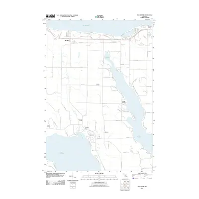
2011 Map of Bay Shore
USGS Topo · Published 2011About this map
Lake Michigan dominates the northern horizon of this coastal landscape, where the settlement of Bay Shore sits along the southern shore. The 2011 survey reveals a transitional area of northern Michigan defined by its prominent water bodies, including the irregular finger-like reach of Walloon Lake and the northern tip of Lake Charlevoix. Transportation history is visible through the Abandoned Rail corridor that roughly parallels Old US 31 Hwy, tracing the former industrial and passenger routes of the region. Local genealogy is well-supported by the inclusion of several burial grounds, such as North Bay Cemetery, Horton Bay Cemetery, and Dyer Cemetery. On the northeastern shore, the Penn-Dixie Cement Corporation marks a significant industrial footprint near the water's edge, while residential pockets like Zenith Heights and Horton Bay dot the inland shoreline.
Find a feature on this map
88 named features on this map. Tap any name to fly to it.
Don’t see what you’re looking for? This feature index may not catch every label — zoom into the map to look around manually.
Map Details
Editions of this 2011 Bay Shore Map
This is the sole edition of this map. No revisions or reprints were ever made.
Other maps of this area

1955 · Cheboygan
USGS Topo · 1:250,000

1958 · Cheboygan
USGS Topo · 1:250,000

1958 · Bayshore
USGS Topo · 1:62,500

1958 · Petoskey
USGS Topo · 1:62,500

1961 · Boyne Falls
USGS Topo · 1:62,500

1961 · Boyne City
USGS Topo · 1:62,500

1975 · Petoskey NW
USGS Topo · 1:24,000

1975 · Boyne City NW
USGS Topo · 1:24,000

1975 · Petoskey SW
USGS Topo · 1:24,000

1975 · Boyne City NE
USGS Topo · 1:24,000