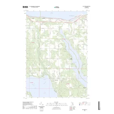
2023 Map of Bay Shore
USGS Topo · Published 2023About this map
Horton Bay sits at the southern edge of this landscape, reflecting a quiet corner of Northern Michigan where the waters of Lake Charlevoix and Walloon Lake are separated by the rising glacial terrain of the Charlevoix Co and Emmet Co line. This area is noted for its several small burial grounds, including Indian Cem, North Bay Cem, and Dyer Cem, which speak to the deep-rooted families and early inhabitants of the region.
Find a feature on this map
82 named features on this map. Tap any name to fly to it.
Don’t see what you’re looking for? This feature index may not catch every label — zoom into the map to look around manually.
Map Details
Editions of this 2023 Bay Shore Map
This is the sole edition of this map. No revisions or reprints were ever made.
Other maps of this area

1955 · Cheboygan
USGS Topo · 1:250,000

1958 · Cheboygan
USGS Topo · 1:250,000

1958 · Bayshore
USGS Topo · 1:62,500

1958 · Petoskey
USGS Topo · 1:62,500

1961 · Boyne Falls
USGS Topo · 1:62,500

1961 · Boyne City
USGS Topo · 1:62,500

1975 · Petoskey NW
USGS Topo · 1:24,000

1975 · Boyne City NW
USGS Topo · 1:24,000

1975 · Petoskey SW
USGS Topo · 1:24,000

1975 · Boyne City NE
USGS Topo · 1:24,000