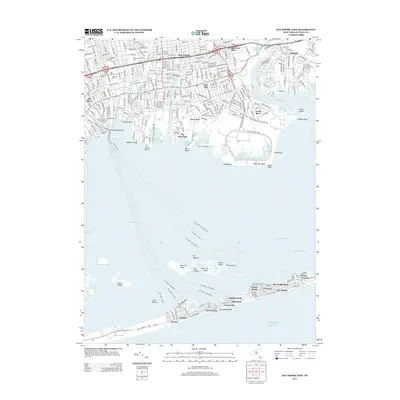
2013 Map of Bay Shore East
USGS Topo · Published 2013About this map
Great Cove and the waters of Nicoll Bay define the maritime character of this Long Island coastal area. On the mainland, established residential communities such as Islip Terrace, East Islip, and Oakdale are bounded by the Connetquot River to the east and the transit corridors of Sunrise Hwy and Montauk Hwy. Local history is anchored by landmarks like Oakwood Cem and Saint Patricks Cem, while the waterfront is marked by the Bay Shore Marina and Fire Island Ferry Terminal.
Find a feature on this map
74 named features on this map. Tap any name to fly to it.
Don’t see what you’re looking for? This feature index may not catch every label — zoom into the map to look around manually.
Map Details
Editions of this 2013 Bay Shore East Map
This is the sole edition of this map. No revisions or reprints were ever made.
Other maps of this area

1901 · Babylon
USGS Topo · 1:62,500

1901 · Northport
USGS Topo · 1:62,500

1902 · Setauket
USGS Topo · 1:62,500

1902 · Fire Island
USGS Topo · 1:62,500

1903 · Babylon
USGS Topo · 1:62,500

1903 · Northport
USGS Topo · 1:62,500

1903 · Fire Island
USGS Topo · 1:62,500

1904 · Setauket
USGS Topo · 1:62,500

1904 · Islip
USGS Topo · 1:125,000

1919 · Setauket
USGS Topo · 1:62,500