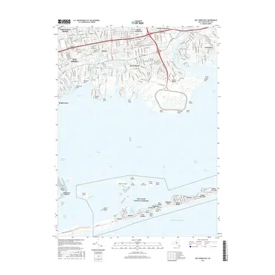
2016 Map of Bay Shore East
USGS Topo · Published 2016About this map
Fire Island National Seashore dominates the southern portion of this landscape, separating the Atlantic from the mainland with a string of seasonal communities and protected dunes. Along this narrow barrier, walkable settlements like Kismet, Saltaire, and Ocean Beach are connected by interior paths such as S Bay Walk and Pacific Walk rather than standard road networks. To the north, the mainland transition from Bay Shore to Oakdale is defined by the Long Island railroad corridor and a complex system of freshwater bodies, including Orowoc Lake and Upper Winganhauppauge Lake. The coastal geography is shaped by numerous points and inlets, most notably Orowoc Point and the Connetquot River, which flows into Nicoll Bay. This 2016 survey documents the established suburban residential patterns of Islip and East Islip alongside the preserved natural environments of the bay islands.
Find a feature on this map
88 named features on this map. Tap any name to fly to it.
Don’t see what you’re looking for? This feature index may not catch every label — zoom into the map to look around manually.
Map Details
Editions of this 2016 Bay Shore East Map
This is the sole edition of this map. No revisions or reprints were ever made.
Other maps of this area

1901 · Babylon
USGS Topo · 1:62,500

1901 · Northport
USGS Topo · 1:62,500

1902 · Setauket
USGS Topo · 1:62,500

1902 · Fire Island
USGS Topo · 1:62,500

1903 · Babylon
USGS Topo · 1:62,500

1903 · Northport
USGS Topo · 1:62,500

1903 · Fire Island
USGS Topo · 1:62,500

1904 · Setauket
USGS Topo · 1:62,500

1904 · Islip
USGS Topo · 1:125,000

1919 · Setauket
USGS Topo · 1:62,500