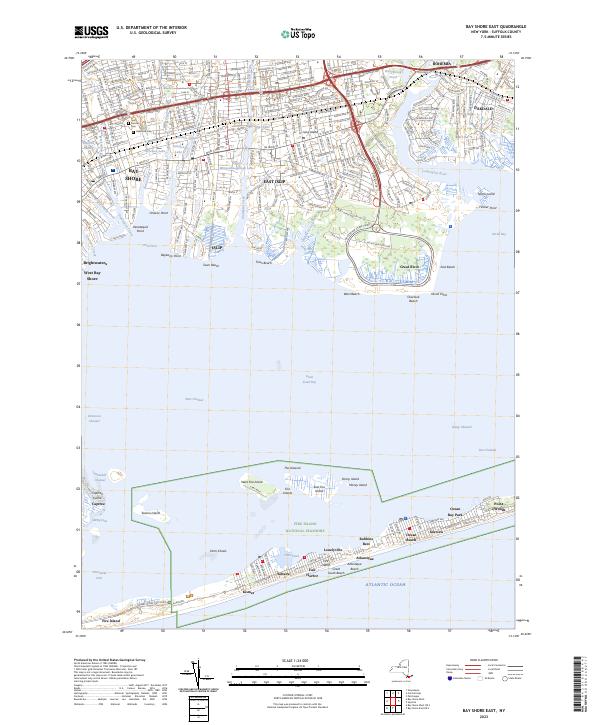
2023 Map of Bay Shore East
USGS Topo · Published 2023About this map
Fire Island National Seashore defines the southern reach of this coastal landscape, protecting a string of seaside communities including Ocean Beach, Saltaire, and Point o'Woods. This barrier island is separated from the mainland by the Great South Bay, where navigators use the West Channel and Dickerson Channel to reach the shore. On the Long Island mainland, the settlements of Bay Shore, East Islip, and Bohemia show a dense suburban pattern typical of the modern era, yet they remain anchored by traditional landmarks like Saint Patricks Cem and Oakwood Cem. Significant conservation areas, including Heckscher State Park and the Seatuck National Wildlife Refuge, preserve the natural shoreline along Great Cove and the mouth of the Connetquot River. The geography highlights the complex relationship between residential growth and the tidal environment of the Atlantic coast.
Find a feature on this map
76 named features on this map. Tap any name to fly to it.
Don’t see what you’re looking for? This feature index may not catch every label — zoom into the map to look around manually.
Map Details
Editions of this 2023 Bay Shore East Map
This is the sole edition of this map. No revisions or reprints were ever made.
Other maps of this area

1901 · Babylon
USGS Topo · 1:62,500

1901 · Northport
USGS Topo · 1:62,500

1902 · Setauket
USGS Topo · 1:62,500

1902 · Fire Island
USGS Topo · 1:62,500

1903 · Babylon
USGS Topo · 1:62,500

1903 · Northport
USGS Topo · 1:62,500

1903 · Fire Island
USGS Topo · 1:62,500

1904 · Setauket
USGS Topo · 1:62,500

1904 · Islip
USGS Topo · 1:125,000

1919 · Setauket
USGS Topo · 1:62,500