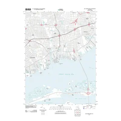
2011 Map of Bay Shore West
USGS Topo · Published 2011About this map
Babylon and the neighboring shoreline communities of Lindenhurst and West Islip define this 2011 snapshot of the Long Island coast. The landscape is characterized by its intricate canal systems and numerous necks, including Santapogue Neck and Okenok Neck, which reach into the Great South Bay. Marine activity is centered around facilities like the Watts Degarmo Boat Yard and several coastal preserves. Inland, the map documents significant local landmarks such as Belmont Lake and several major burial grounds, including Saint John's Catholic Cemetery and Breslau Cemetery. The transportation network is dominated by the Southern State Pkwy and the Robert Moses State Pkwy, the latter of which provides a vital link across the water toward Oak Beach and the shifting sands of Democrat Point at the Fire Island Inlet.
Find a feature on this map
83 named features on this map. Tap any name to fly to it.
Don’t see what you’re looking for? This feature index may not catch every label — zoom into the map to look around manually.
Map Details
Editions of this 2011 Bay Shore West Map
This is the sole edition of this map. No revisions or reprints were ever made.
Other maps of this area

1901 · Babylon
USGS Topo · 1:62,500

1901 · Northport
USGS Topo · 1:62,500

1902 · Setauket
USGS Topo · 1:62,500

1902 · Fire Island
USGS Topo · 1:62,500

1903 · Babylon
USGS Topo · 1:62,500

1903 · Northport
USGS Topo · 1:62,500

1903 · Fire Island
USGS Topo · 1:62,500

1904 · Setauket
USGS Topo · 1:62,500

1904 · Islip
USGS Topo · 1:125,000

1919 · Setauket
USGS Topo · 1:62,500